
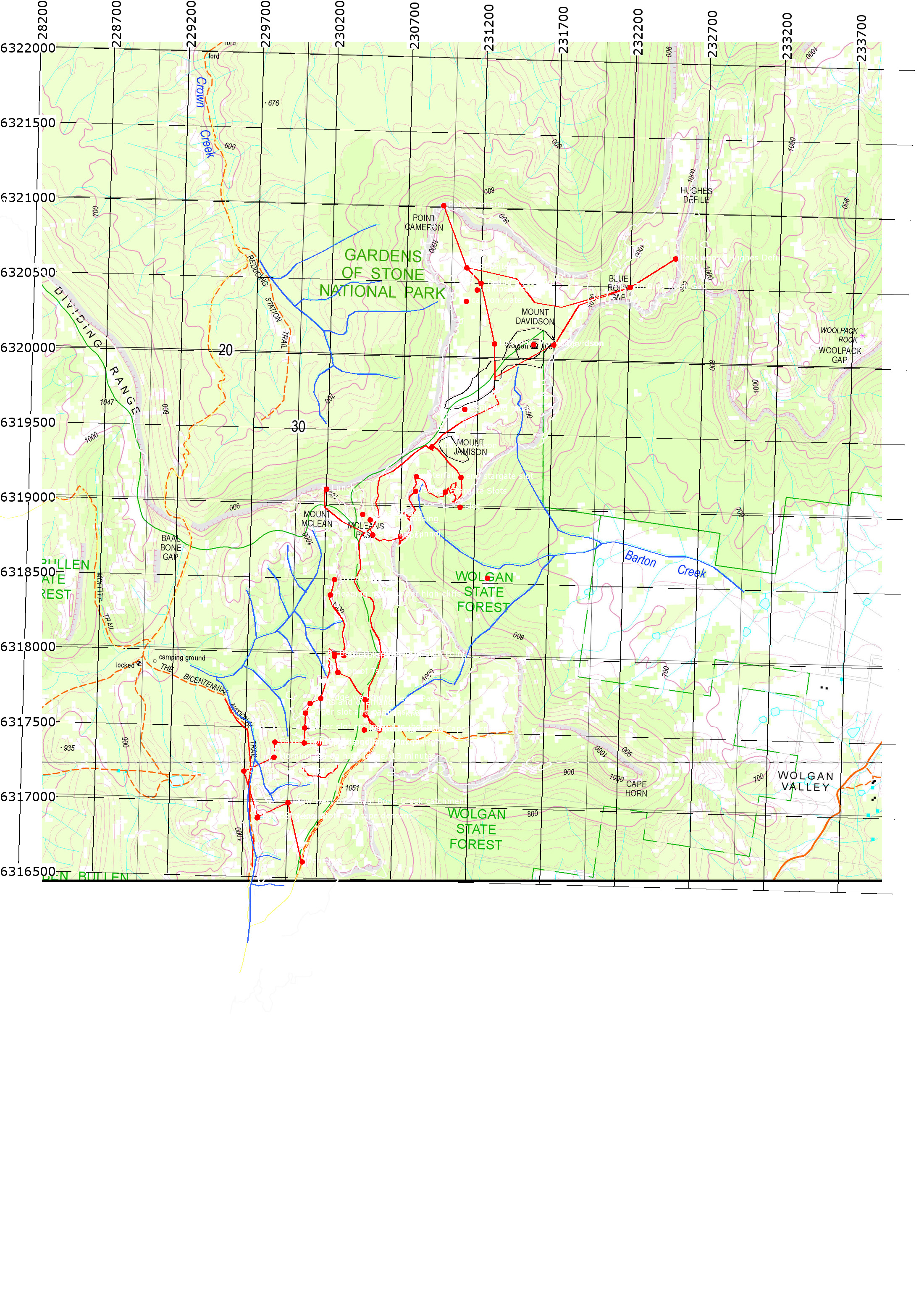
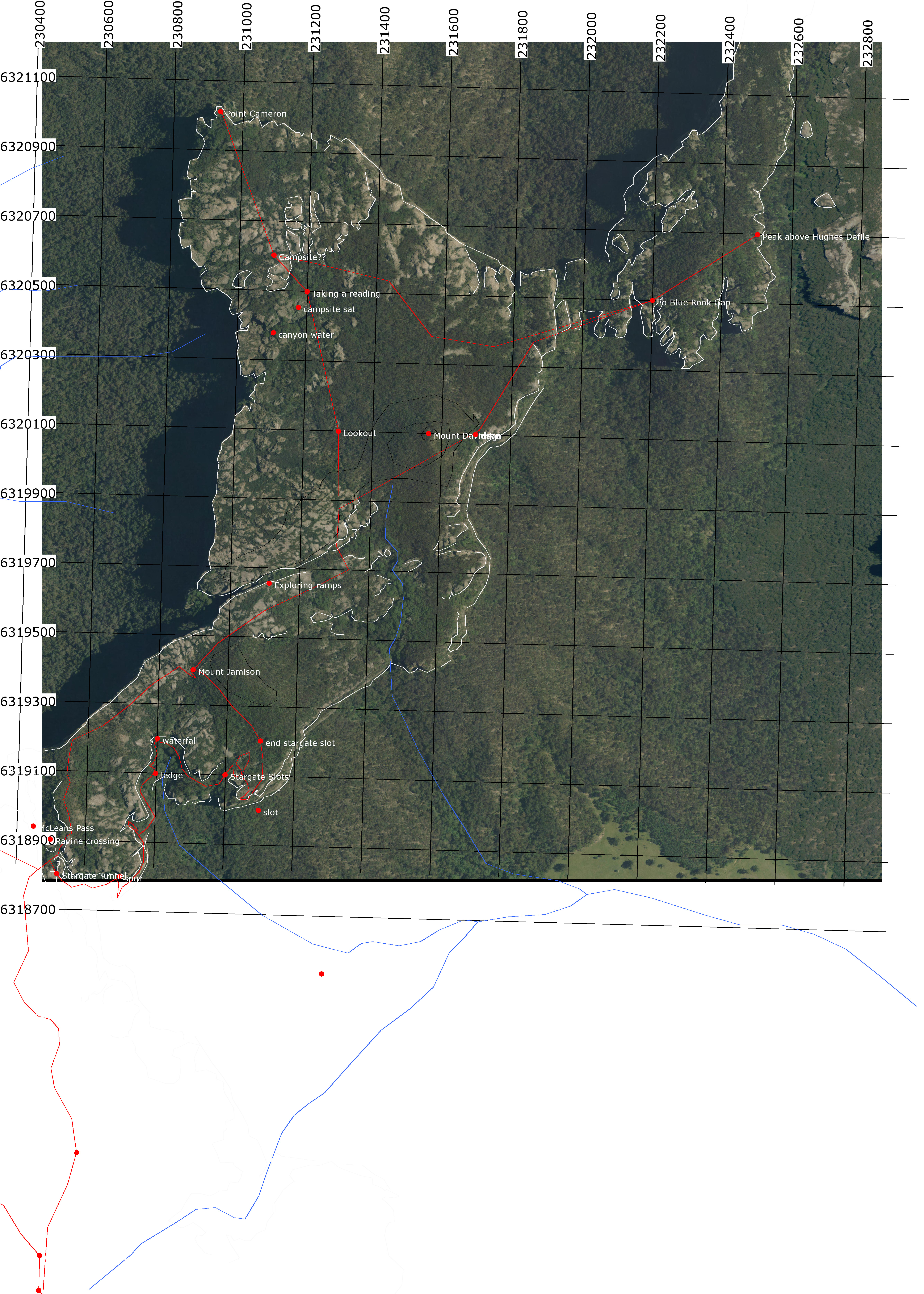
Info
walking distance: 14.6 kmduration: 6:00 h
walking: 0:52 h
elevation diff: 1060 m
location: wollemi - gardens of stone
driving distance: 143 km
driving time: 2:35 h
water available: puddles in a canyon
parking: -33.1731,150.2378

gps tracks
Total distance: 15110 m
Max elevation: 1092 m
Min elevation: 974 m
Total climbing: 1095 m
Total time: 06:00:40
Download file: 16-04-02-stargate_tunnel-3.gpxMax elevation: 1092 m
Min elevation: 974 m
Total climbing: 1095 m
Total time: 06:00:40


