Info
walking distance: 4.2 kmduration: 0:00 h
walking: 0:00 h
elevation diff: 245 m
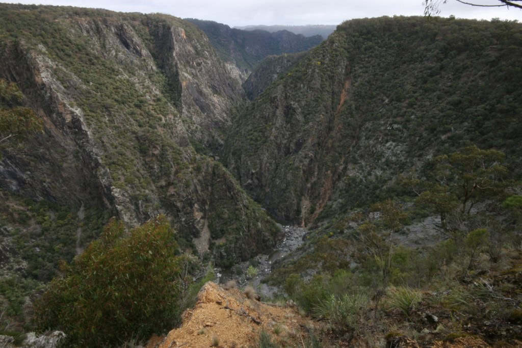
location: Oxley Wild Rivers National Park
driving distance: 506 km
driving time: 6 h
water available:
parking: -30.5314,152.0333

gps tracks
Max elevation: 939 m
Min elevation: 886 m
Total climbing: 245 m
Video
Alerts
Oxley Wild Rivers National Park
Closed areas: Threlfall Walking Track and Gara Gorge Lookout are closed due to flooding
Threlfall Walking Track and Gara Gorge Lookout are closed until Monday 3 April 2023 at 4:30pm due to flooding.
For further information please contact Armidale office on (02) 6738 9100, or Walcha office on 6777 4700.
Closed areas: Edgars Lookout and Picnic Area are Closed
Edgars Lookout and picnic area are closed until Thursday 6 April 2023 at 4:30pm for maintenance to the lookout structure.
For further information contact Armidale office on (02) 6738 9100, or Walcha office on (02) 6777 4700.
Closed areas: Areas closed for aerial pest control operation
Some areas of Oxley Wild Rivers National Park are closed from 4:00 pm, Monday 27 March to 7:00 am, Wednesday 29 March 2023 for an aerial pest control operation. The closed areas are:
- Riverside campground
- Budds Mare to Riverside walking track
- Youdale's campground
- Mary's View Lookout