Info
walking distance: 5.0 kmduration: 3:55 h
walking: 1:31 h
elevation diff: 268 m
location: Namadgi National Park
driving distance: 360 km
driving time: 4:45 h
water available:
parking: -35.6033,148.9519

gps tracks
Max elevation: 1375 m
Min elevation: 1316 m
Total climbing: 259 m
Total time: 03:55:21
Max elevation: 1357 m
Min elevation: 1156 m
Total climbing: 335 m
Total time: 03:27:42
Video
Track notes
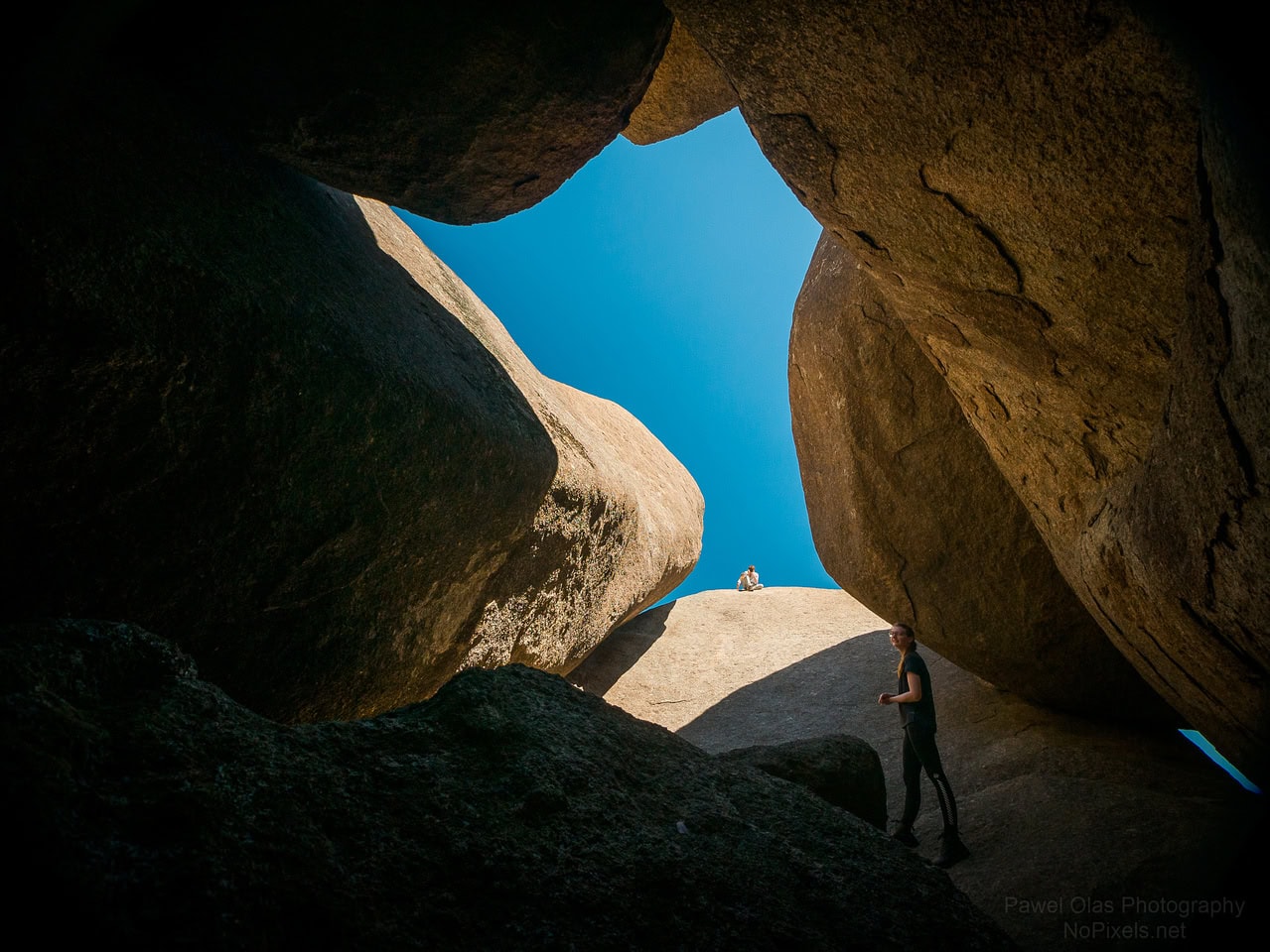
BOOROOMBA ROCKS
This walk starts at the Booroomba Rocks Carpark some 3-km along a gravel road branching off the
Apollo Road at about 18-km from the NVC. A formed walking track from the carpark leads to the
top of Booroomba Rocks for views into the Blue Gum Creek area of Namadgi and the Tuggeranong
Valley. Be warned this walk has a steep 200-m plus climb. The platform top of the rocks is a good
place for a rest break with a view. Rock climbers can often be seen scaling the 200-m high granite
cliffs of Booroomba Rocks. Time could be spent exploring along the length of the rock platform.
Care should be taken near the edge of the rock cliffs especially where children are involved. • Walking distance – 4-km return • Grade – Moderate due to steep climb
ORRORAL RIDGE
Orroral Ridge, often referred to as the ‘Ridge of Stone’, overlooks the Orroral Valley and has
numerous interesting large rocky (granite) outcrops. Access to the ridge is from the Honeysuckle
Creek Campground at the site of the now demolished tracking station, 19-km from the NVC, along a
3.5-km unsealed road to a parking area on the ridgeline. Some of the rock outcrops along the ridge
have been given colloquial names by the bushwalking fraternity; ‘Cloisters’ (0.5-km south-east of the
parking area), ‘Belfry’ (a further 0.5-km south-east), ‘Legoland’ (0.5-km north-west of the parking
area) and ‘Sentinal Rocks’ (a further 1-km north-west). Well worn bush-tracks lead to all these rock
outcrops. It is interesting to explore the in and outs of the rocky outcrops including overhangs and
what could be described as tunnels. Several of the outcrops, ‘Legoland’ in particular, have flattish
rock shelves with spectacular views to the southern parts of Namadgi across the Orroral Valley. There
are many other rock outcrops in the vicinity which are worth a look. Return along the same bushtracks. • Walking distance – about 6-km (2-km south-east and 4-km north-west) visiting all 4 outcrops. • Grade – Easy


